Wetlands Area Monitoring & Workflow Management
The population in rural areas is widely distributed with no associated sewage pipeline network. Typically, domestic sewages are poured along the streets or discharged into rivers/streams directly. Discharging untreated sewage into rivers and streams worsens water quality and pollutes groundwater after penetration. The mixed rainwater and sewages increase the workload of sewage treatment and processing.

Our Strategy
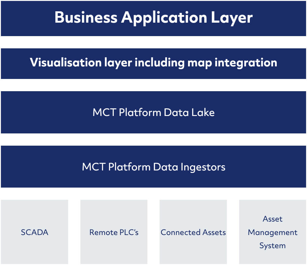
CT deployed its MeridianCT (MCT) IoT platform to monitor and manage the network of wetland areas.
Starting by aggregating the client’s siloed systems data, which included, water quality stations, remote PLC’s, SCADA and asset management system into the MeridianCT platform.
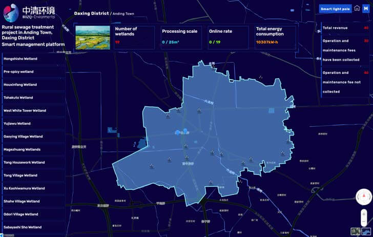
CT then created a customised dashboard with an integrated map visualisation layer.


Application & Visualisation Layer
The MeridianCT platform ingests data from a centralised SCADA system and remote distributed assets at the wetland areas. It provides a single pane view of all connected assets via a GIS layer, allowing for easy navigation and visualisation of critical parameters, and improved monitoring of vegetation health within the designated wetland areas.
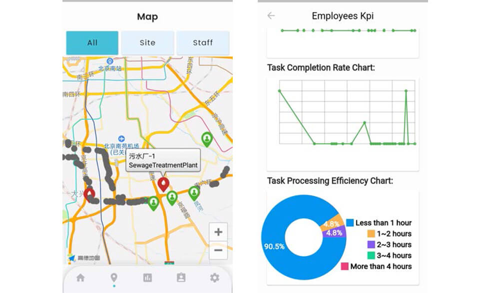
Mobile Application Workflow Management
When the MeridianCT system detects poor water quality outside the expected range or equipment anomalies, the system will trigger alerts and assign work orders via the mobile application to authorised executors, so corresponding actions can be taken. All work order and maintenance tasks are stored within the MeridianCT platform and tracked against KPI’s to ensure the highest level of service is maintained.

The MeridianCT platforms allows operations to monitor data with a variety of dashboards, as well as facilitate remote equipment control. In addition, data will be kept within the MeridianCT platform allowing Anding Water Authority to conduct statistical analysis, as well as develop data analytical models, ultimately providing the tool for better ecological management.
Transformation
Transformation
- Able to better visualise and manage 19 wetlands areas and other remote assets within their control
- Save costs in operations and maintenance
- Able to form management decisions on the basis of scientific data, ultimately contributing to their environmental goals

